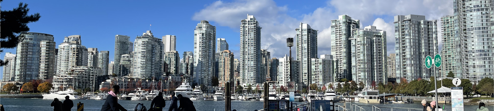
Bridging My Urban Planning Experience from Vancouver to Toronto

This post reflects on my journey transitioning from urban planning in Vancouver to understanding Ontario’s planning policies. I explore how my experience with land use reports, community engagement, and sustainability projects in BC connects to key GTA policies like the Provincial Planning Statement (PPS) and Growth Plan for the Greater Golden Horseshoe. My cross-regional knowledge equips me to contribute to sustainable, community-driven development in the Toronto area.
Equity in Zoning: Three Directions Forward

This project critically examines the City of New Westminster’s current Zoning Bylaw to understand if and how the City’s land-use regulations are contributing to and perpetuating inequity within the City.
Active Transportation Facilities Design in Zhuhai, China
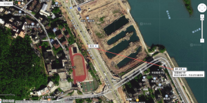
This project studies active transportation (Greenway) facilities design in a newly developed area in the City of Zhuhai, China. Multiple mini projects focusing on street audits, site analysis, covid-related design changes were conducted to examine the challenges of future transportation planning and active transportation facilities design.
Envisioning A Car-Free UBC Campus - A Planning Brief Prepared for UBC Campus and Community Planning
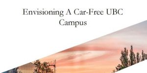
This planning brief is prepared for UBC Campus and Community Planning in exploring the idea of a car-free campus for the UBC Vancouver Campus.
Internship Reflection Report - Community Engagement Intern at VCH
This brief report presents my reflection on my learnings and take-away from a four-month internship working as a Community Engagement Intern at Vancouver Coastal Health.
Faciliating Vancouver Plan Community Engagement Event
Faciliating Vancouver Plan Community Engagement Event
Smart Cities Start-up Business Proposal: Leveraging Technology for Community Engagement in Urban Planning

This project provides a data-driven design solution to the real-world urban challenge of the community engagement gap in development planning. Along with the proposal, a start-up pitch for potential investors, an initial budget, and a critique of its social implications were presented in this Planning course focusing on smart cities.
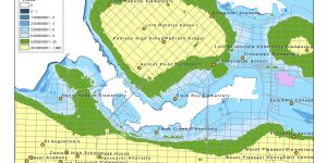
Environmental Impact Assessment - Garibaldi at Squamish ski resort project
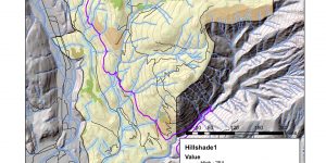
Assessing environmental impact for the Garibaldi at Squamish ski resort project on ArcGIS
Under-Representation in Night-Time Transportation

A qualitative research on Metro Vancouver night-time transportation during the covid-19 pandemic.
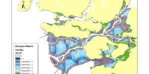
Regional Read | Write Group Project - Site analysis based on topography and natural systems

This group project focuses on the theme of topography and natural systems in the context of the City of Surrey. Our group first created a number of regional mappings of the City of Surrey, then developed a schematic design proposal based on the theme.
Nodal Read|Write Project - Surrey Scott Road Station Area

This group project brought together two different ways of ‘reading’ the site of Scott Road Station in the City of Surrey—one experience and observation-based, the other focusing more on abstract forms of research—with ‘writing’ a very schematic proposal for the area.
Potential Affordable Housing Site in Toronto
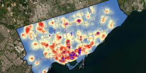
This project analyses spatial relation between location of affordable housing and socioeconomic conditions and use MCE and MaxEnt to propose new potential affordable housing building sites in city of Toronto.
Cartography: British Columbia

A map of British Columbia including major cities, mountains, and water features.
Professional Development Reflection - GEOB 270
A brief reflection on my GIS learning in GEOB 270 - Introduction to GIS
Housing Affordability Analysis
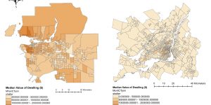
Visualizing the housing affordability issue in Metro Vancouver and make comparison with Montreal
GEOB270: Accomplishment Statement
A summary of what I learned and achieved in an introductory GIS course