lab3: storm surge
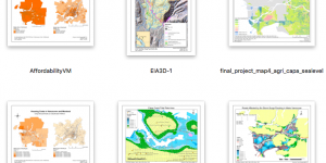
In this lab, I learned to identify the data I need and the GIS analysis tools to be performed, and to evaluate the integrity of spatial data. Specifically, I created a set of maps to show the potential zone affected by a storm surge event in Metro Vancouver, analyzed then visualized the impact of storm surge on transportation, education and healthcare facilities.
lab4: housing affordability
In this lab, I gained working knowledge on how to access Canada census data, process tabular data, and standardize spatial data to visualize the housing affordability issue in Metro Vancouver. I explored various quantitative data classification methods and gained a better insight in how the choice of classification method could influence the layout and message convey by the exported map.
lab5: Environmental impact assessment
I produced an environmental impact assessment map for the Garibaldi at Squamish ski resort project. In the process, I learned to develop a geodatabase for the project to parse and filter data, explored more spatial analysis tools, such as spatial joins, merging layers, and creating 3D hillshade.


Learning Significance